

High slack on Sunday evening brought in our friend Sam (and some visiting family) on Safe Harbour, his Nordic Tug 37. We were the only two boats in Ford’s Terror for the next two nights and it was fantastic. In the morning Sam took his family out for a Terror Tour in his dinghy, and we took our tandem kayak out. The weather had improved quite a bit since yesterday.


After kayaking, we hung out a bit on Sam’s top deck and Sam and Kevin both flew their drones for some nice footage of our anchorage:


When it was getting close(ish) to low tide, Sam and Kevin and I went out in Sam’s (fast) dinghy to check out the shoals at the entrance. Wow, was THIS an educational trip. The current was still pretty hefty (ebbing at about 10 knots) when we got there. We did a little “testing” in the dinghy to see what the current felt like (safely). Here’s what the waves/overfalls looked like from the slightly calmer side of the entrance:


We pulled into a little notch just before the rapids, secured the dinghy, and went ashore.

Sam brought his drone to get some aerial shots during low tide…shoal research!

This was extremely educational, since Ford’s Terror is not very well charted (or charted at all, in most places). There are shoals that don’t show up on any charts, and charted rocks that aren’t even there. And in fact, the best path from the waterfall outside of Ford’s Terror to the narrow entrance into the fjord actually takes you directly over one of the charted “rocks.” Sam is writing a full article about Ford’s Terror for Slowboat, so I’ll just show you one quick shot from Sam’s drone, and then come back and link to that article when it’s ready. It’s gonna be good!
In Sam’s shot below, his drone is basically backed up to the tall waterfall, looking toward the narrow entrance. The yellow line is the recommended path from the waterfall to the narrows:

Here’s what the charts show. This is the Navionics vector chart, showing our path from the waterfall (bottom of chart) in through the narrows:

And this is all the info you get on the NOAA raster charts:

Not too helpful, is it?
Sam took the dinghy back out on his own while Kevin used Sam’s drone to get video of him going in and out of the narrows while it was still churning a bit.

We all hung out on shore watching the rapids slow so we could see when slack was, and on this day low slack occurred about an hour and thirty-five minutes after Juneau low slack.
Right about low slack now:

When we took the dinghy back out to head home, we first headed out to the tall waterfall and then came in on a direct line from the waterfall to mid-channel, using the depth sounder to find the lowest water (7.2 feet on a 1.2 ft low).
Bonus while we waited on shore watching the tide change: tidepools!


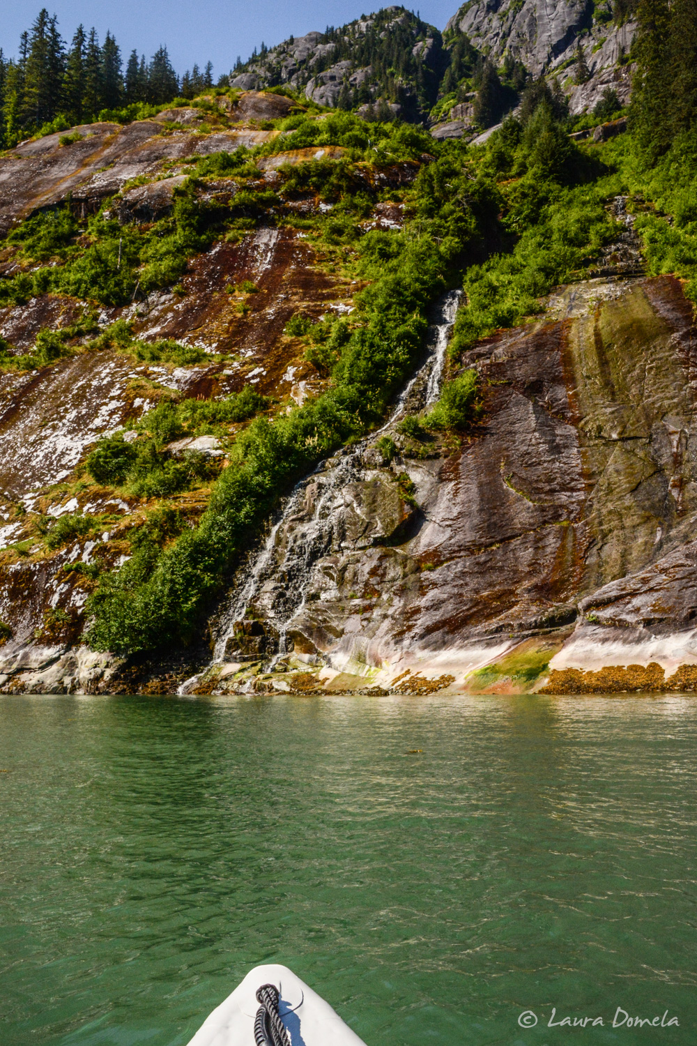
On our way back to the anchorage we got a nice closeup of one of the MANY waterfalls in here:

Looking into the east arm of Ford’s Terror at low tide, you can really see the rocks and shoals that stick out in the entrance:

(We did a little depth sounding here too and found about 3 feet…eeek!)
Back in the west arm we got a little more quality time with our grizz on shore while he moved some more rocks:

We did a group dinner tonight on Safe Harbour…so much fun, in such an amazing place. Can’t wait to be back!

Title got me 🙂
I was all “oh no!”
Haha, sorry ’bout that! 🙂
Fantastic photos as always and great exploration of ford’s terror. I hit a nearly invisible bergie bit yesterday just outside the entrance to FT on way back from Dawe’s glacier. We poked our nose into FT for a look see, but after hitting the bergie bit I decided I’d had enough drama for one day! In Juneau until Monday. Wondering if you guys night be here? Would love to meet up with you guys and/or Sam. Have a diver coming in the morning just to make sure there’s no damage. Tough boats!
Thanks Casey! Bummer about the invisible bergie bit. We’re just over at Admiralty Cove tonight and heading back into Juneau tomorrow. Picking up some friends on the 5th and will be just cleaning the boat and doing laundry (and watching fireworks, of course) until then. Sam’s back out at Ford’s Terror with a new batch of visitors. Let’s meet up! What’s your schedule like? We’re staying at our friend Steve’s dock (between Harris and Aurora, below the harbormasters’s office….
Fantastic. Completely flexible tomorrow. We’re in Harris Hbr, on float #1 in one of the transient side tie spots. Green Goose. Green hulled NT 42. I’ll try to find your dock tomorrow if there’s open access to it. Otherwise stop by float #1 at Harris! Second boat from shore in front of Bayliner 58
Btw, diver is coming by between 7-8 in the morning. Not sure how long it will take, but I will certainly be at the boat until he’s done.
We’re 3 hours from Juneau and not sure when we’ll head that way, so…I’m guessing later in the afternoon. There’s open access to the dock…it’s the Nordic Tug Charters dock, and I think there will be at least two NTs there tomorrow. If you’ve got AIS, you’ll be able to see when we get in. 🙂
Ok, let’s look for each other tomorrow afternoon. We’ll both have front row seats for the fireworks tomorrow night.